Modeling Terrain and Topography in SketchUp
Creating realistic terrain and topographic models is essential for architects, landscape designers, and urban planners. SketchUp, a popular 3D modeling software, offers powerful tools for this purpose. One of the most effective tool sets in SketchUp for terrain modeling is the Sandbox tools.
Introduction to Sandbox Tools
The Sandbox tools in SketchUp are designed specifically for creating and modifying terrain. They are part of the SketchUp Pro suite and include several functions that allow users to create, edit, and refine terrain models with ease. The primary tools within the Sandbox set include:
a. From Contours: This tool generates a terrain surface from a series of contour lines.
b. Sandbox Tools: A collection of tools for creating and manipulating terrain surfaces.
c. Drape: This tool projects lines or shapes onto a terrain surface, useful for roads and pathways.
d. Stamp: This tool creates flat areas on a terrain model, ideal for building pads or parking lots.
e. Smoove: This tool smooths and manipulates terrain surfaces, allowing for more organic shapes.
Let's delve into how to use these tools to create realistic terrain and topographic models.
A. Creating Terrain from Contour Lines
Step 1: Importing Contour Lines
To start modeling terrain, you need contour lines, which can be imported from various sources such as CAD files, GIS data, or manually drawn within SketchUp. Importing contour lines from a CAD file involves using the File > Import option and selecting the appropriate file format (e.g., .dwg, .dxf).
Step 2: Organizing Contour Lines
Once the contour lines are imported, it's essential to organize them into a single group or component. This helps in managing the model and applying the Sandbox tools more effectively. Select all contour lines and group them using Edit > Make Group or Edit > Make Component.
Step 3: Generating the Terrain
With the contour lines grouped, select the group and go to Draw > Sandbox > From Contours. SketchUp will generate a terrain surface based on the contour lines. This terrain model is a mesh that accurately represents the topography defined by the contour lines.
B. Refining Terrain with Sandbox Tools
Smoove Tool
The Smoove tool is used to refine and smooth terrain surfaces. Select the Smoove tool from the Sandbox toolbar, then click and drag on the terrain surface to manipulate it. You can adjust the radius of the Smoove tool to control the area of influence. This tool is particularly useful for creating gentle slopes and natural-looking terrain features.
Drape Tool
The Drape tool allows you to project edges onto a terrain surface. This is useful for adding roads, paths, or other linear features to your terrain. To use the Drape tool, draw the desired line or shape on a flat plane above the terrain, select the line or shape, and then go to Draw > Sandbox > Drape. The line or shape will be projected onto the terrain surface.
Stamp Tool
The Stamp tool is used to create flat areas on a terrain surface, such as building pads or parking lots. To use the Stamp tool, draw the outline of the flat area on a flat plane above the terrain, select the outline, and then go to Draw > Sandbox > Stamp. You can adjust the height and slope of the stamped area to fit your needs.
C. Adding Detail to Terrain
Creating Roads and Paths
Creating roads and paths on your terrain model can add realism and context. Use the Drape tool to project road or path outlines onto the terrain. Then, use the Smoove tool to adjust the terrain around the roads or paths, ensuring a natural integration with the surrounding landscape.
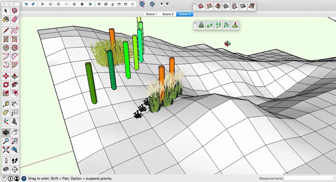
Adding Vegetation and Features
Vegetation and features such as trees, bushes, rocks, and water bodies can significantly enhance the realism of your terrain model. SketchUp’s 3D Warehouse offers a vast library of free 3D models that you can import into your scene. Place these models strategically to create a believable and visually appealing environment.
D. Enhancing Terrain with Textures and Materials
Applying Textures
Textures play a crucial role in enhancing the visual realism of terrain models. SketchUp allows you to apply different materials and textures to your terrain surface. Select the terrain surface, open the Materials window (Window > Materials), and choose a suitable texture from the library or import your own.
Blending Textures
For more realism, blend multiple textures to create varied terrain surfaces. For example, you can blend grass, dirt, and rock textures to represent different areas of the terrain. Use the Paint Bucket tool and adjust the opacity of each texture to achieve a seamless blend.
Using Photorealistic Textures
Photorealistic textures can significantly enhance the realism of your terrain model. These textures are high-resolution images that replicate real-world surfaces. You can find photorealistic textures online or create your own using high-quality photographs. Apply these textures to your terrain model using the same method described above.
E. Advanced Techniques
Creating Custom Terrain Models
In some cases, you may need to create custom terrain models that don’t rely on contour lines. You can do this by manually sculpting the terrain using the Sandbox tools. Start by drawing a grid or mesh on a flat plane, then use the Smoove tool to shape the terrain. This method gives you complete control over the terrain’s shape and features.
Integrating Terrain with Building Models
Integrating terrain with building models is crucial for creating comprehensive site plans. Import or create your building model and place it on the terrain. Use the Stamp tool to create a flat area for the building, ensuring it sits naturally within the landscape. Adjust the surrounding terrain with the Smoove tool for a seamless integration.
To learn more, watch the following video tutorial.
Video Source: TheSketchUpEssentials
Using Plugins for Enhanced Terrain Modeling
SketchUp offers various plugins that can enhance terrain modeling capabilities. Plugins like Toposhaper and Artisan provide advanced tools for creating and refining terrain models. These plugins can automate complex tasks and offer more detailed control over the terrain surface.
Conclusion
Creating realistic terrain and topographic models in SketchUp is a valuable skill for designers and planners. The Sandbox tools offer a robust set of features for generating, refining, and enhancing terrain surfaces. By mastering these tools and techniques, you can create detailed and visually stunning terrain models that enhance your design projects.
Whether you're an architect designing a site plan, a landscape designer creating a garden, or an urban planner developing a city model, the ability to create realistic terrain in SketchUp is essential. Experiment with the various tools and techniques discussed in this article to develop your terrain modeling skills and take your designs to the next level.