Using SketchUp for Urban Planning
What do you mean by Urban Planning?
Urban planning is the process of designing and managing the physical, social, and economic development of cities, towns, and other urban areas. It involves developing strategies and policies that promote sustainable development, improve quality of life, and create livable communities.
Urban planners work to balance the needs of different groups of people, such as residents, businesses, and government agencies, while considering factors such as transportation, land use, housing, public spaces, and environmental sustainability.
Urban planning also involves evaluating and addressing issues related to urban growth and development, such as traffic congestion, air pollution, and affordable housing. The goal of urban planning is to create vibrant, healthy, and sustainable urban communities that meet the needs of all residents.
What is the use of SketchUp by urban planners?
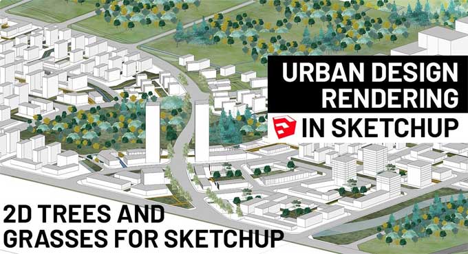
SketchUp is a 3D modelling software that allows users to create realistic, detailed models of buildings, streetscapes, and entire urban landscapes. With SketchUp, urban planners can visualize proposed developments and assess their impact on the existing environment. They can also use SketchUp to create presentations and simulations that help stakeholders understand the potential impact of different urban design scenarios.
Additionally, SketchUp can be used to create detailed architectural and engineering drawings, which can be used to guide construction and development activities. In summary, while it's not a requirement, the use of SketchUp can greatly enhance the work of urban planners by allowing them to create accurate 3D models of urban environments and to communicate their ideas and proposals more effectively.
How is SketchUp used by urban planners?
SketchUp is a popular 3D modelling software tool used by urban planners for a variety of purposes. Here are some ways urban planners use SketchUp:
1. Site Analysis: SketchUp can be used to create 3D models of existing urban environments, which can be analyzed and assessed to inform urban planning decisions. Planners can use SketchUp to import site plans and other relevant data, and then create a 3D model to better understand the site and its context.
2. Conceptual Design: SketchUp is a useful tool for conceptual design, allowing planners to quickly create and manipulate 3D models of proposed developments. This can help planners to visualize different design options and assess their feasibility before committing resources to a particular plan.
3. Visualization: SketchUp can be used to create highly realistic visualizations of proposed developments, allowing planners to communicate their ideas to stakeholders and the public. These visualizations can be used in presentations, community meetings, and public hearings.
4. Analysis: SketchUp can be used to analyze the impact of proposed developments on their surrounding environment, including the impact on views, sunlight, and shading. Planners can use SketchUp to create models that simulate the impact of a proposed development on its surroundings, which can help inform urban planning decisions.
5. Construction: SketchUp can be used to create detailed architectural and engineering drawings, which can be used to guide construction and development activities. These drawings can be used to ensure that developments are built to specification and that they meet all relevant regulations and guidelines.
SketchUp is a versatile tool that can be used by urban planners for a variety of purposes, including site analysis, conceptual design, visualization, analysis, and construction.
What are some different SketchUp tools that urban planners use?
There are a variety of SketchUp tools that urban planners can use to create and manipulate 3D models of urban environments. Here are some examples of SketchUp tools commonly used by urban planners:
1. Push/Pull Tool: This tool is used to create 3D shapes by extruding flat shapes in a specific direction. It is commonly used to create buildings, streetscapes, and other urban features.
2. Follow Me Tool: This tool is used to create complex 3D shapes by extruding flat shapes along a path. It is commonly used to create curved or irregular shapes, such as curved roads or sloped landscapes.
3. Move Tool: This tool is used to move and manipulate objects within the 3D model. It can be used to adjust the placement of buildings, streets, and other urban features.
4. Line Tool: This tool is used to create straight lines and edges within the 3D model. It is commonly used to create building footprints, street layouts, and other geometric features.
5. Arc Tool: This tool is used to create curved lines and edges within the 3D model. It is commonly used to create curved roads, sidewalks, and other features with a radius.
6. Section Plane Tool: This tool is used to create cross-sectional views of 3D models. It is commonly used to analyze the internal structure of buildings, streetscapes, and other urban features.
7. Tape Measure Tool: This tool is used to measure distances and angles within the 3D model. It is commonly used to ensure that urban features are built to specification and to calculate setback requirements and other planning standards.
8. Scale Tool: This tool is used to resize objects within the 3D model. It can be used to adjust the size of buildings, streets, and other urban features.
9. Offset Tool: This tool is used to create parallel lines and edges within the 3D model. It is commonly used to create setback lines, building facades, and other features that require a consistent offset distance.
To learn more, watch the following video tutorial.
Video Source: SketchUp
10. Paint Bucket Tool: This tool is used to apply textures and colours to surfaces within the 3D model. It can be used to create realistic building facades, streetscapes, and other urban features.
11. Intersect Tool: This tool is used to create intersections between different objects within the 3D model. It is commonly used to create complex shapes, such as intersections between streets and buildings.
12. Sandbox Tools: This set of tools is used to create and manipulate terrain within the 3D model. It can be used to create hills, valleys, and other natural features that are important to the urban landscape.
13. Layers Tool: This tool is used to organize objects within the 3D model into different layers. It is commonly used to keep different aspects of the model separate, such as buildings, streets, and natural features.
14. Plugins: SketchUp has a large library of plugins that can be used to extend the software's capabilities. Some plugins that are particularly useful for urban planners include ones for generating 3D models from GIS data, analyzing solar exposure, and calculating building energy performance.
In summary, there are a wide range of SketchUp tools and plugins that urban planners can use to create, manipulate, and analyze 3D models of urban environments. The specific tools and plugins used will depend on the specific needs of the planner and the project at hand.